

Tap Tap to Zoom
Product Discontinued by Manufacturer
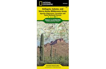
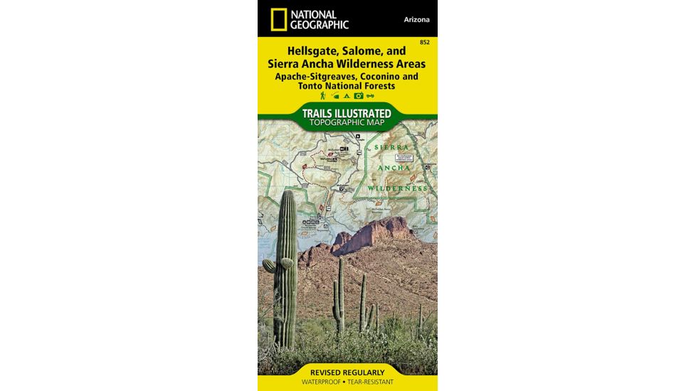
National Geographic Hellsgate, Salome, and Sierra Ancha Wilderness Areas -Apache-Sitgreaves, Coconino, and Tonto National Forests- has been discontinued by National Geographic and is no longer available. Our product experts have helped us select these available replacements below.You can also explore other items in the Outdoor Gear yourself to try and find the perfect replacement for you!
Product Info for National Geographic Hellsgate, Salome, and Sierra Ancha Wilderness Areas -Apache-Sitgreaves, Coconino, and Tonto National Forests-
One of the most-visited urban forests in the U.S., with approximately 5.8 million visitors annually, the Tonto National Forest spans almost 3 million acres of diverse terrain just outside of Phoenix, AZ. Tonto encompasses a wide variety of vegetation ranging from cactus-studded desert to pine-forested mountains, and numerous recreational opportunities throughout the year. Our four new Trails Illustrated maps are the most detailed and up-to-date for the forest, carefully researched and developed in co-operation with local land managers and agencies. Each map contains easy to read trails, numbered forest service roads, campsites, access points, scenic points-of-interest, and important facilities. Like all Trails Illustrated maps our new Tonto National Forest titles are both highly durable and environmentally friendly. Each map is printed in the United States, at a certified green printer, using low V.O.C. inks on waterproof, tear-resistant material. Proceeds from the sale of Tonto National Forest Trails Illustrated Maps go to support the National Geographic Society's nonprofit mission to increase global understanding and promote conservation of our planet through exploration, research, and education.![]()
Features of National Geographic Hellsgate, Salome, and Sierra Ancha Wilderness Areas -Apache-Sitgreaves, Coconino, and Tonto National Forests-:
- Agency Contact and Recreation Information
- Highline and General Crook National Recreation Trails
- Arizona Trail
- Desert to the Tall Pines Scenic Byway
- Roosevelt Lake and Wildlife Area
- Portions of Coconino and Apache - Sitgreaves National Forests
- Locations of Public Facilities and Fee Areas
- Motorized and Non-Motorized Trails
- Equestrian and Multiple Use Trails
- Mogollon Rim Area and Sierra Ancha Mountains
- Hellsgate, Salome and Sierra Ancha Wilderness Areas
- Tonto Natural Bridge State Park
- Payson, Pleasant Valley, and Tonto Basin Ranger Districts
- Map Scale = 1:70,000
- Sheet Size = 25.5" x 37.75"
- Folded Size = 4.25" x 9.25"
- Waterproof - Tear-Resistant - Topographic Map
Package Contents:
- National Geographic Hellsgate, Salome, and Sierra Ancha Wilderness Areas -Apache-Sitgreaves, Coconino, and Tonto National Forests-
National Geographic Hellsgate, Salome, and Sierra Ancha Wilderness Areas -Apache-Sitgreaves, Coconino, and Tonto National Forests-


National Geographic Hellsgate, Salome, and Sierra Ancha Wilderness Areas -Apache-Sitgreaves, Coconino, and Tonto National Forests- Unavailable & Discontinued Models
List of Unorderable Models
- Hellsgate, Salome, and Sierra Ancha Wilderness Areas (Apache-Sitgreaves, Coconino, and Tonto National Forests) , MPN: nag0416 , UPC: 749717008526 , Code: 44-MAP-NAG0416